


Greater Fairbanks, Greater Juneau, Ketchikan Gateway Borough & Road-Connected Alaska PUMA, Alaska
About
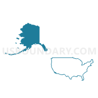
Outline

Summary
| Unique Area Identifier | 192117 |
| Name | Greater Fairbanks, Greater Juneau, Ketchikan Gateway Borough & Road-Connected Alaska PUMA |
| State | Alaska |
| Area (square miles) | 98,717.24 |
| Land Area (square miles) | 89,429.57 |
| Water Area (square miles) | 9,287.66 |
| % of Land Area | 90.59 |
| % of Water Area | 9.41 |
| Latitude of the Internal Point | 62.14867300 |
| Longtitude of the Internal Point | -143.28681930 |
Maps

Graphs
Select a template below for downloading or customizing gragh for Greater Fairbanks, Greater Juneau, Ketchikan Gateway Borough & Road-Connected Alaska PUMA, Alaska


Neighbors
Neighoring Public Use Microdata Area (by Name) Neighboring Public Use Microdata Area on the Map
- Anchorage Municipality (North) PUMA, AK
- Anchorage Municipality (South) PUMA, AK
- Matanuska-Susitna & Kenai Peninsula Boroughs PUMA, AK
- Subsistence Alaska PUMA, AK
Top 10 Neighboring County (by Population) Neighboring County on the Map
- Anchorage Municipality, AK (291,826)
- Fairbanks North Star Borough, AK (97,581)
- Matanuska-Susitna Borough, AK (88,995)
- Kenai Peninsula Borough, AK (55,400)
- Juneau City and Borough, AK (31,275)
- Ketchikan Gateway Borough, AK (13,477)
- Valdez-Cordova Census Area, AK (9,636)
- Southeast Fairbanks Census Area, AK (7,029)
- Yukon-Koyukuk Census Area, AK (5,588)
- Prince of Wales-Hyder Census Area, AK (5,559)
Top 10 Neighboring County Subdivision (by Population) Neighboring County Subdivision on the Map
- Anchorage census subarea, Anchorage Municipality, AK (291,826)
- Fairbanks North Star census subarea, Fairbanks North Star Borough, AK (97,581)
- Matanuska-Susitna census subarea, Matanuska-Susitna Borough, AK (88,995)
- Juneau census subarea, Juneau City and Borough, AK (31,275)
- Ketchikan census subarea, Ketchikan Gateway Borough, AK (13,477)
- Southeast Fairbanks census subarea, Southeast Fairbanks Census Area, AK (7,029)
- Chugach census subarea, Valdez-Cordova Census Area, AK (6,684)
- Seward-Hope census subarea, Kenai Peninsula Borough, AK (5,667)
- Prince of Wales census subarea, Prince of Wales-Hyder Census Area, AK (4,012)
- Koyukuk-Middle Yukon census subarea, Yukon-Koyukuk Census Area, AK (3,219)
Top 10 Neighboring Place (by Population) Neighboring Place on the Map
- Anchorage municipality, AK (291,826)
- Fairbanks city, AK (31,535)
- Juneau city and borough, AK (31,275)
- Badger CDP, AK (19,482)
- College CDP, AK (12,964)
- Ketchikan city, AK (8,050)
- Steele Creek CDP, AK (6,662)
- Chena Ridge CDP, AK (5,791)
- Farmers Loop CDP, AK (4,853)
- Valdez city, AK (3,976)
Top 10 Neighboring Unified School District (by Population) Neighboring Unified School District on the Map
- Anchorage School District, AK (291,826)
- Fairbanks North Star Borough School District, AK (97,581)
- Matanuska-Susitna Borough School District, AK (88,995)
- Kenai Peninsula Borough School District, AK (55,400)
- Juneau Borough School District, AK (31,275)
- Ketchikan Gateway Borough School District, AK (13,477)
- Delta/Greely School District, AK (4,810)
- Valdez City School District, AK (3,976)
- Copper River School District, AK (2,826)
- Haines Borough School District, AK (2,508)
Top 10 Neighboring State Legislative District Lower Chamber (by Population) Neighboring State Legislative District Lower Chamber on the Map
- State House District 15, Rural Mat-Su, AK (25,974)
- State House District 11, North Pole, AK (21,692)
- State House District 16, Chugiak-South Mat-Su, AK (21,559)
- State House District 7, Farmers Loop-Steese Highway, AK (20,982)
- State House District 8, Denali-University, AK (19,960)
- State House District 32, Chugach State Park, AK (19,952)
- State House District 35, Homer-Seward, AK (17,419)
- State House District 10, Fairbanks-Fort Wainwright, AK (16,548)
- State House District 9, City of Fairbanks, AK (16,149)
- State House District 4, Juneau-Mendenhall Valley, AK (15,842)
Top 10 Neighboring State Legislative District Upper Chamber (by Population) Neighboring State Legislative District Upper Chamber on the Map
- State Senate District H, AK (47,533)
- State Senate District D, AK (40,942)
- State Senate District P, AK (37,696)
- State Senate District F, AK (36,503)
- State Senate District E, AK (32,697)
- State Senate District R, AK (31,989)
- State Senate District B, AK (31,275)
- State Senate District A, AK (28,984)
- State Senate District C, AK (28,081)
Top 10 Neighboring 111th Congressional District (by Population) Neighboring 111th Congressional District on the Map
Top 10 Neighboring Census Tract (by Population) Neighboring Census Tract on the Map
- Census Tract 19, Fairbanks North Star Borough, AK (11,684)
- Census Tract 15, Fairbanks North Star Borough, AK (10,052)
- Census Tract 11, Fairbanks North Star Borough, AK (8,143)
- Census Tract 14, Fairbanks North Star Borough, AK (7,357)
- Census Tract 2, Juneau City and Borough, AK (7,083)
- Census Tract 12, Fairbanks North Star Borough, AK (6,854)
- Census Tract 13, Fairbanks North Star Borough, AK (6,462)
- Census Tract 9, Fairbanks North Star Borough, AK (5,772)
- Census Tract 1.01, Anchorage Municipality, AK (5,736)
- Census Tract 3, Juneau City and Borough, AK (5,483)
Top 10 Neighboring 5-Digit ZIP Code Tabulation Area (by Population) Neighboring 5-Digit ZIP Code Tabulation Area on the Map
- 99709, AK (29,830)
- 99801, AK (29,164)
- 99705, AK (22,544)
- 99701, AK (19,019)
- 99712, AK (13,866)
- 99901, AK (13,508)
- 99567, AK (9,211)
- 99703, AK (7,065)
- 99737, AK (5,011)
- 99664, AK (4,932)